Román Alarcia Pérez

The beginning of my summer adventure exploring the seas.
Let me introduce myself. Hi! I´m Román Alarcia Pérez, I came from Albacete, Spain and I´m here to tell you about me and my summer project.
Since I was a child I´ve always been interested in science fiction stories and I have often dreamed of living in one of those fantasy worlds. Being guided by this curiosity in science and technology I decided to do a bachelor in physics in the university of Valencia, Spain. After that I went to Besançon, France in order to continue my studies with a master program in computational science. During this year I realized that applying computer science to physical problems is my real passion in life, so I decided to continue my prospective career in this way.
How did I get involved in PRACE?
Some months ago, our master head sent us an email with an internship offer. At the beginning I thought that it was just spam, but I went to the link, and I found out that PRACE summer of HPC could give me the opportunity of working in really interesting topics in many fields. So, I decided to apply to this program, and I got accepted in the one that was the most interesting for me:
“Automated Extraction of Satellite Bathymetric data by Artificial Intelligence strategies”
Maybe the name is a little bit long and technical, so I will try to translate it.
My project
Nowadays we already have many maps of the solar system, of the milky way and even of other galaxies, we have even observed black holes! So, planet Earth must be well known too, or not?
Well, actually we have maps in detail of the land, but the oceans still remain as a mystery. So far, we could only map about the 20% of the ocean´s seabed. Scientifics all over the world are making great efforts to map the seabed using different techniques. Most of these techniques consist of sailing the seas with sensors, which is very expensive and one of the reasons why we couldn´t map completely the oceans yet. When we sail the seas with sensors, the deeper the seabed, the faster and the cheaper we can work. So, many of the not deep waters, also called shallow waters, have not been explored yet due to its time and money costs.
Although the earth surface can be directly observed by satellite, we cannot do the same for the ocean´s surface because light doesn´t penetrate in deep waters. But recent studies have demonstrated that they have a better accuracy for measuring shallow waters. These techniques are very experimental for the moment, but they can be an important tool for mapping these not deep waters.
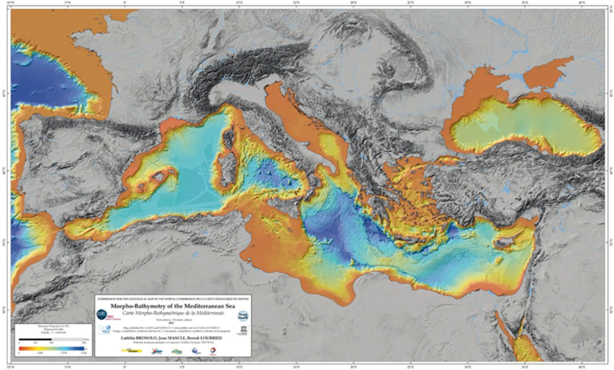
Here it is where my project starts. I will work with machine learning to map the seabed of the shallow waters from images collected by satellite. In concrete, in some areas of the south of Italy. This map of the seabed is called bathymetric map, and here we see an example of the bathymetric map for the Mediterranean Sea.
What can be expected from this project?
I have to confess that I have never imagined myself working in such an interesting project and I´m quite excited. Thanks to PRACE summer of HPC and CINECA I can participate in this project and maybe even discover something interesting, who knows. I will do my best to get interesting results and come back with fresh news about the project in the following weeks.
Are you interested in the topic, and you want to know more? What would you expect from this project? Don´t be shy and let me know comments and questions, I will be happy to answer them.
